
Geographic Information Systems
(GIS)


Food Supply Chain Modelling
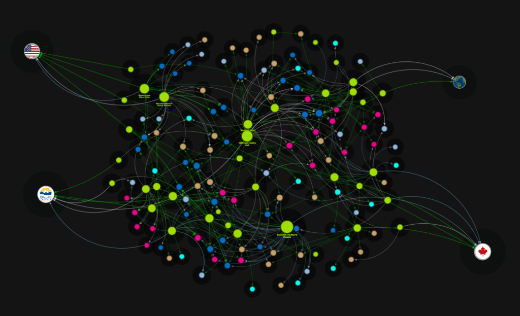
FoodSupplyChain.ca is a collaborative space for stakeholders the food industry, encompassing producers, retailers, non-profits, and other key players. It offers a platform to work together beyond traditional silos, with minimal barriers. The foodsupplychain.ca platform consolidates real-time, crowdsourced data from members into interactive visualizations, offering a comprehensive view of the food supply chain adaptable to any scale. Designed for versatility, it supports various products, processes, and organizational sizes, providing insights into rural supply chains for effective decision-making. Beneficial for a broad spectrum of stakeholders, including consumers, producers, retailers, and more, its implementation is bolstered by partnerships with food policy councils, economic development agencies, educational institutions, and government bodies.
Contact us for more information, or visit FoodSupplyChain.ca
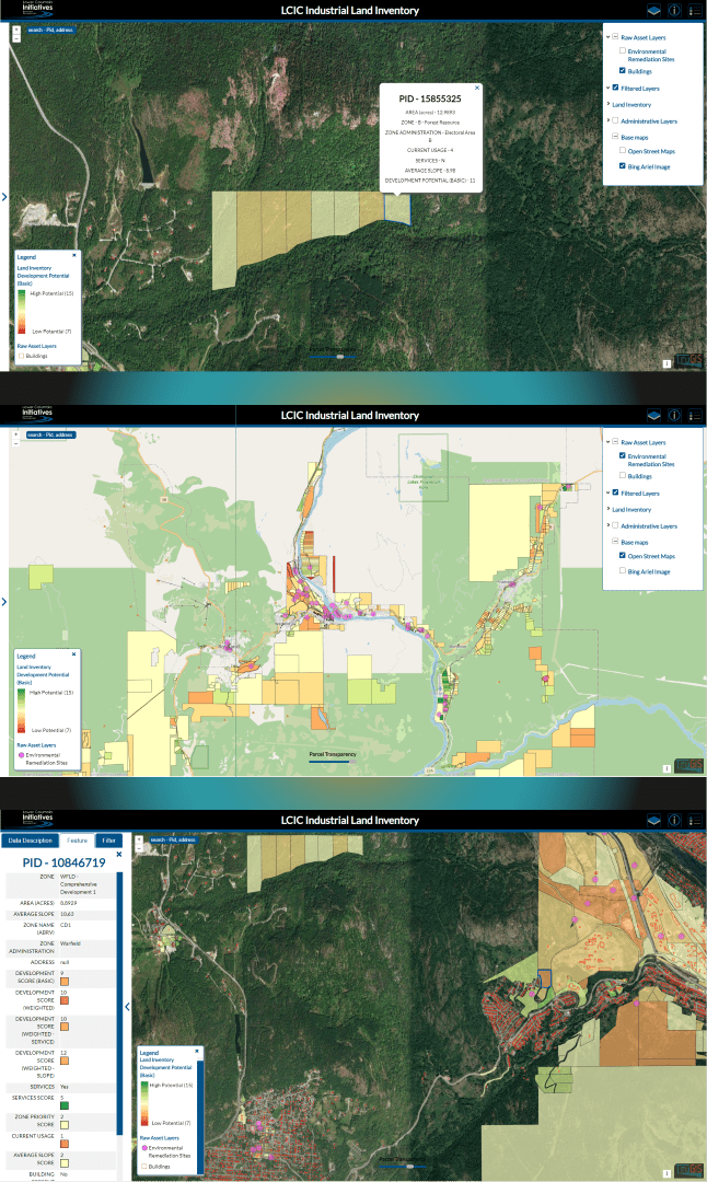
Industrial / Commercial Land Inventories
TruGIS can benefit your community by creating, managing, and mapping your spatial data.
Developed over two years with support from researchers at Selkirk Innovates, and in partnership with the Lower Columbia Initiatives Corporation (LCIC), these maps are designed to facilitate effective planning and management of industrial, commercial, and agricultural lands.
They integrate parcel development potentials, filters, display options, and GIS analysis to create a system that advances local land management strategies. Access to these maps is restricted based on the levels of detail they provide. You are welcome to experiment with the LCIC’s public version, or contact us to request higher levels of access.
View the public version of our system at: lcic.ca/projects/land-inventory
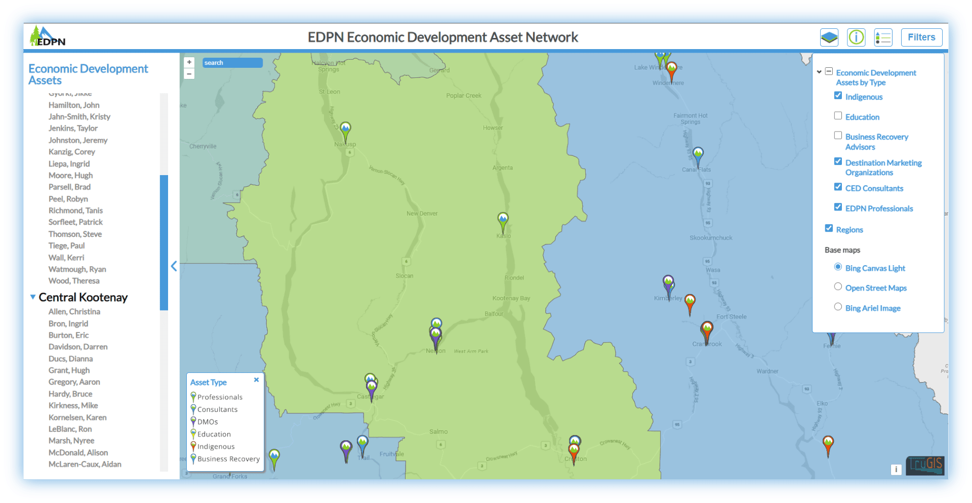
Asset Maps
Elevate your asset management strategy with meaningful and reliable capabilities.
Transform your operations with our data-driven asset maps. Tailored for small to medium-sized organizations, our custom asset tracking solutions go beyond tracking personnel and materials. They encompass structures, industrial/commercial properties, and much more. Further enhance your asset maps with our network modeling services to discover levels of functionality beyond your expectations. Our collaboration with economic experts and researchers has enabled us to develop interactive tools that are invaluable to our partners and clients. To learn more about how our asset mapping services can benefit you, get in touch.
View and interact with the Economic Development Practitioners Network (EDPN) Map at:edpn.trugis.ca
Additional GIS Services
- Consulting
- System design
- System updates
- Road safety analysis
- Cartography
- Resource inventory
- Open-source solutions
- Personnel training
- Spatial data collection
- Aerial image / data collection (UAV)
- Website integration
- Utility mapping
